
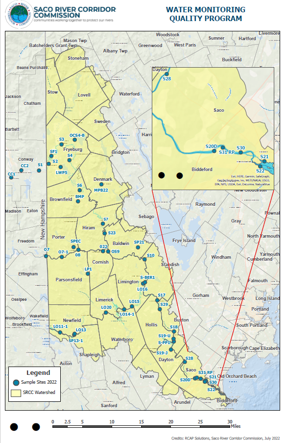
With a Corridor that flows along over 170 miles of river, it is to be expected that the lands adjacent to the waterway experience many different uses. If one were to look at a map of the Saco River Corridor Region, they would see an excellent example of those different uses. As the Saco River enters the state of Maine in Fryeburg and flows south through Brownfield, Denmark, and Hiram, it sees high agricultural and recreational use. As the Saco reaches Cornish and Baldwin, it is joined from the west by the Ossipee River after its 18-mile journey from Ossipee Lake in New Hampshire.
The Ossipee sees a mix of residential, agricultural, and industrial uses as it flows through the villages of Porter and Parsonsfield, Maine. The waters of the Saco and the Ossipee continue through a short distance of residential areas in Limington and Standish — including a couple of campgrounds and a popular swimming spot at the Limington Rapids — before being joined again from the west by the Little Ossipee River. At the confluence of the Little Ossipee and the Saco Rivers, the Little Ossipee has already traveled a distance of 31 miles.
The Little Ossipee sees high residential development as found on the shores of Balch Pond in Acton and Newfield, Shapleigh Pond in Shapleigh, and the Little Ossipee Flowage (Lake Arrowhead) in Limerick and Waterboro. The combined waters of these three great rivers travel through the towns of Buxton and Hollis, passing the sites of existing mills and those long forgotten. As they search for the sea, they finally flow through the quiet landscapes of Dayton and then on to the high demands of Biddeford and Saco, including commercial, industrial, and residential uses. Here the river reaches what could be considered its highest and most critical use — that of a drinking water reservoir. Although this is where the water is drawn from the Saco River by the Biddeford and Saco Water Company, its quality has been affected by all land and water uses from its origin and the origins of the three major tributaries.
When choosing the sites for our program, we tried to pinpoint those areas most critical to the rivers and the communities they support. For example, we chose to test all three rivers as they enter the state of Maine from New Hampshire to give us an idea of the quality of water as it enters the state and the regulatory jurisdiction of the Saco River Corridor Act. It was also very important for us to have each municipality represented. Although at this point it is financially impossible for us to physically take a water sample in each municipality, our testing locations do provide each municipality with data that represents the waters flowing through its community. As the program grows we continually research additional site locations.