One of the questions we’re most often asked is, “What is the quality of the water?” To answer that question before our monitoring program began, we relied on the knowledge that Class A and AA waters stretch over vast segments of the rivers within the Corridor and also that the rivers have a relatively natural and unspoiled look. But there was something missing: Did we actually know the quality of the water? Were we genuinely meeting our agency mission to protect public health, safety, and quality of life without the scientific data that would give us a definitive answer? In 2001, the decision was made to start testing and the Saco River Basin Water Quality Monitoring Program officially began.
The data was initially gathered with the intention that after a few years we would be able to answer the question regarding water quality with actual data to back it up. However, there surfaced another question: why start a water quality monitoring program? What was once, in our minds, the obvious answer to that question is now not so apparent.
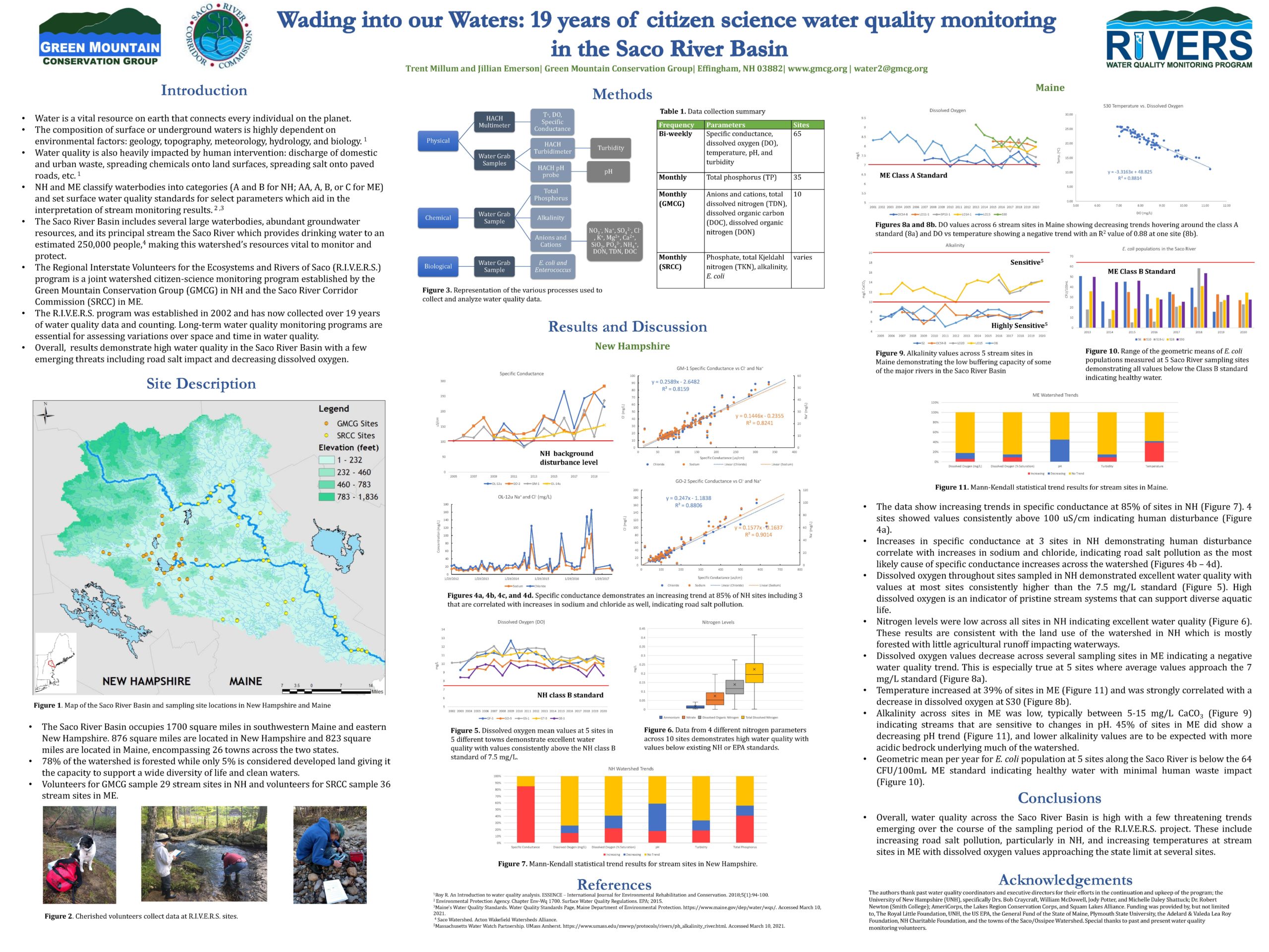
After 20 years of sampling, we have collected a tremendous amount of data that has aided our organization and the municipalities we serve; providing our community members with an opportunity to better understand the conditions of our most precious natural resource. In conjunction with Forrest Bell Environmental Associates (FBE) we have comprised an extensive 10-year water quality analysis report (view here) that has further improved the interpretive power we have from our growing dataset. We’d like to extend a special thanks to the Maine Outdoor Heritage Fund for awarding us a grant to make this analysis a reality. After designing an effective monitoring program to statistically evaluate trends in key water quality parameters, we hope that an in-depth report such as this will assist us in continuing to improve of our program. Rivers are in a constant state of change; and identifying trends in this manner will ultimately allow for the expansion of our monitoring program, and increase the SRCC’s ability to address areas in decline with proper care and attention. Without continued monitoring, all we have is a snapshot of moments in time. While a photo can speak a thousand words, a living documentary can reveal volumes.
A sustainable water quality monitoring program is based on five important steps:
It takes time to effectively progress through each of these steps. Take the first two steps as an example. In order to characterize and understand the general condition of the water with any certainty, you first need to look at no less than three to five years of baseline data. The raw data reveals trend patterns that may highlight consistent problem areas. These patterns may or may not be discovered or even exist in the three- to five-year time frame. If the baseline data doesn’t show any patterns, then a longer time frame of data collection is needed.
Once well-defined patterns are determined, and those same patterns have been studied to create a representation of water quality, you can take the next step based on the patterns observed. If problem areas are noted, you proceed to step four and further monitor trouble spots to determine the pollution source, if any. If no degradation is noted, you can jump to step five.
The fifth step — the most important step for future protection of the rivers — is to continue the program. That is the only way to maintain a working knowledge of the water and the land uses surrounding our rivers.


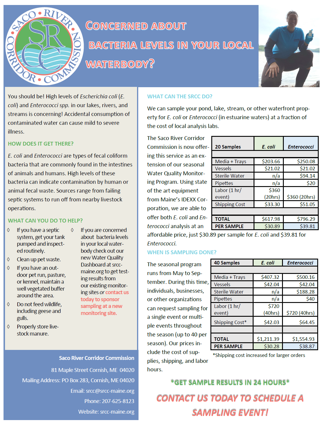
Find out how you can get next day results of bacteria levels at a site near you!
The Saco River Corridor Commission is committed to protecting public health and safety and the quality of life for the state of Maine. The commission regulates land and water uses, protects and conserves the region’s unique and exceptional natural resources, and prevents the detrimental impacts of incompatible development. The commission was established in 1973.