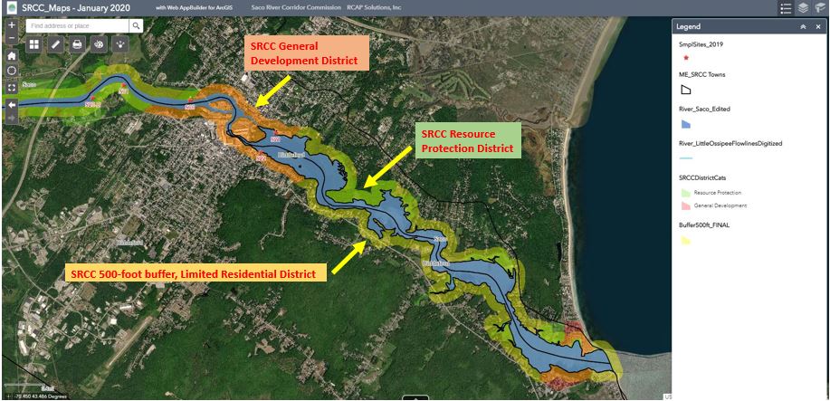
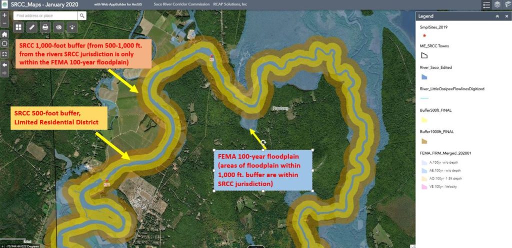
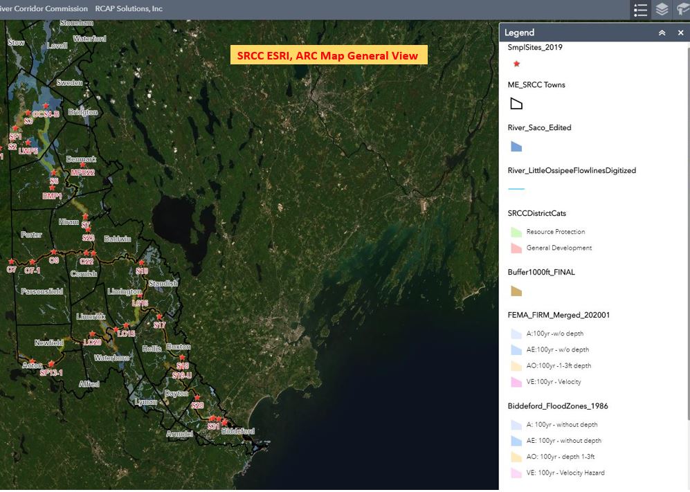
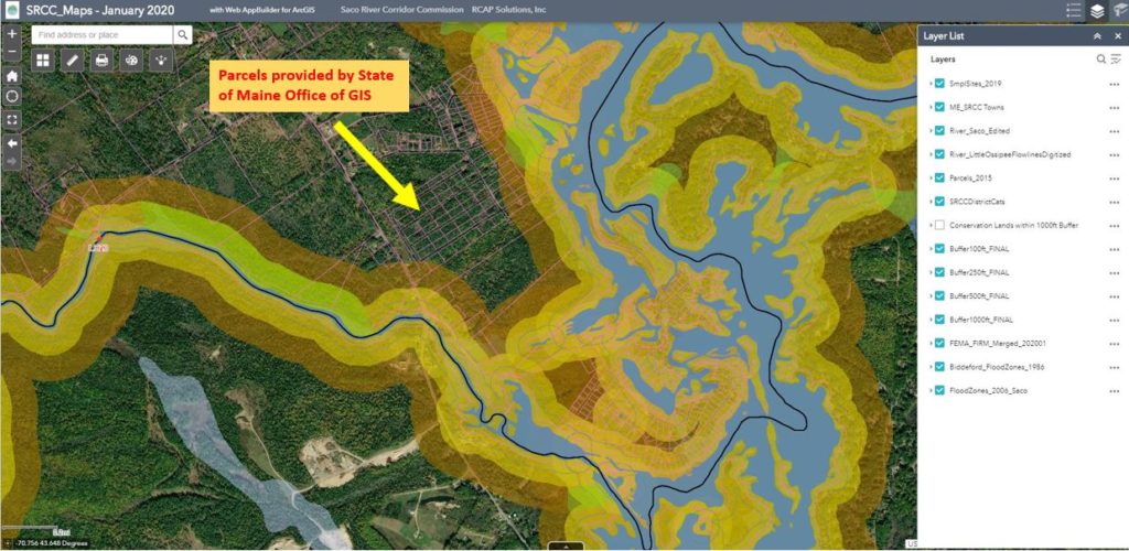
SRCC ArcOnline is a powerful interactive map of the Saco River corridor. Scan the QR code below to explore the map.
Note: This mapping product is for informational purposes and was not prepared for or suitable for legal, engineering, or surveying purposes. It does not represent an on-the-ground survey and represents only the approximate relative location of property boundaries. The Saco River Corridor Commission makes no guarantee concerning the completeness or accuracy of the content. Assessing lot-by-lot accuracy of these maps is the responsibility of the user.
